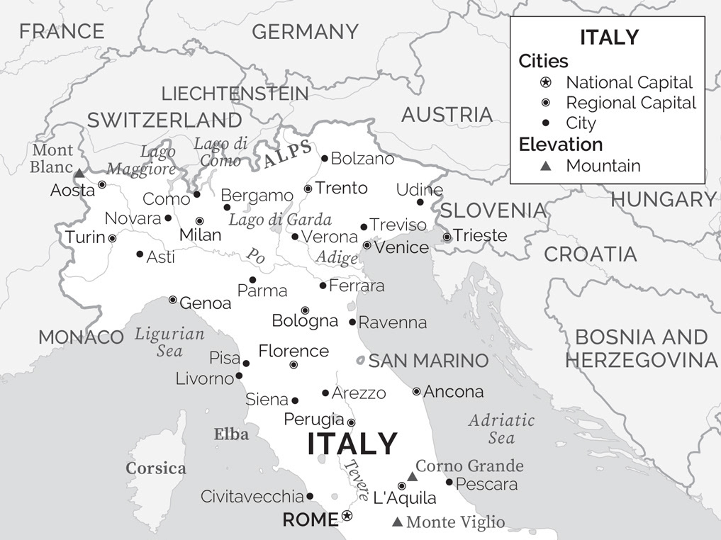
B&W: Simple Flat
2022
Simple black & white map with cities, rivers and political features
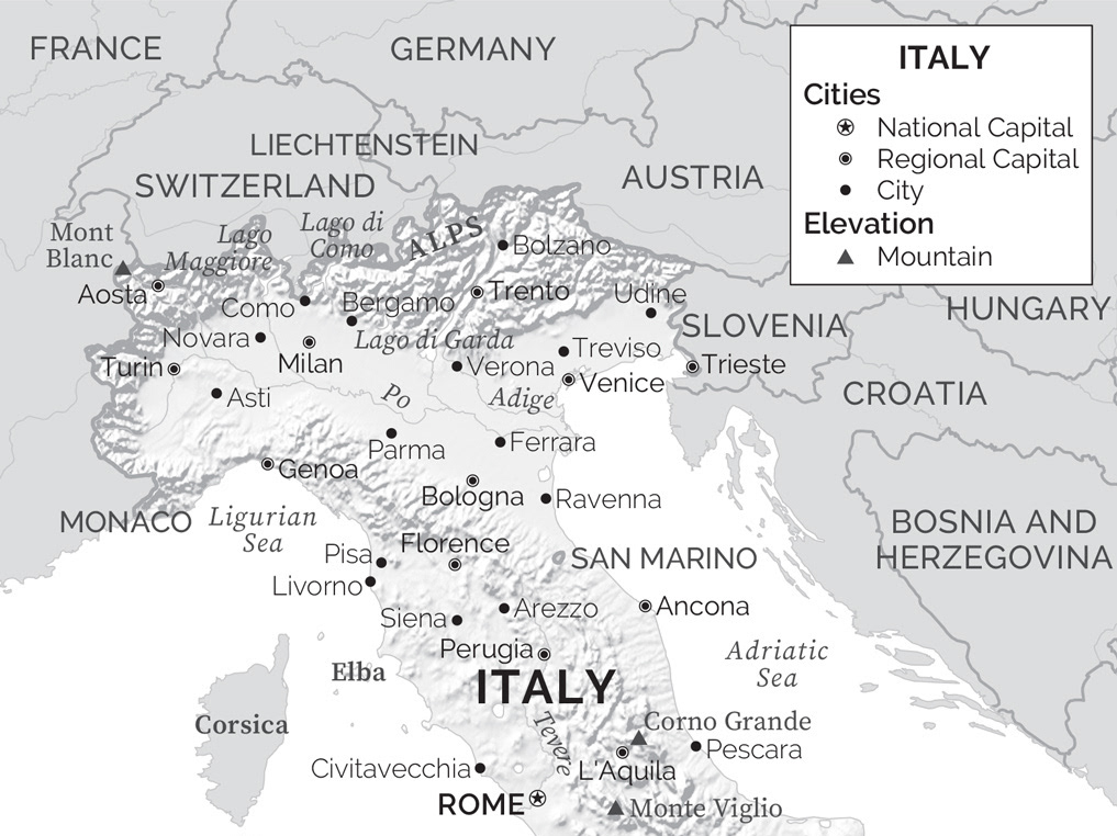
B&W: Simple Topographic
2022
Simple black & white map with relief shading, cities, rivers and political features
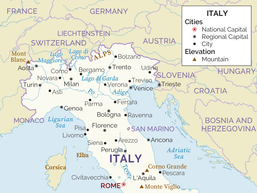
Colour: Simple Flat
2022
Simple colour map with cities, rivers and political features
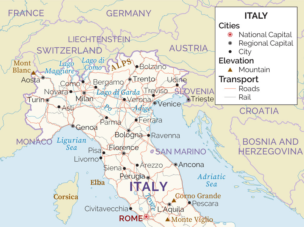
Colour: Simple Roads
2022
Simple colour map with cities, road & rail network, rivers and political features
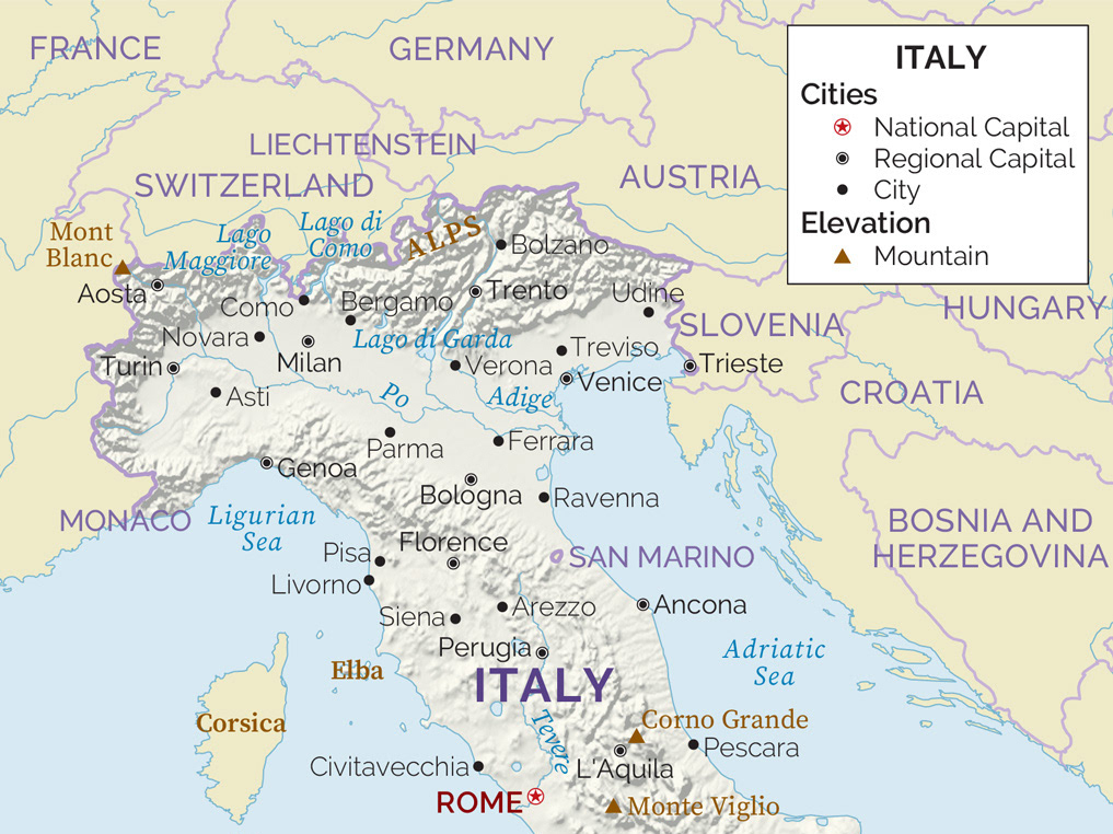
Colour: Topographic
2022
Colour map with relief shading, cities, rivers and political features
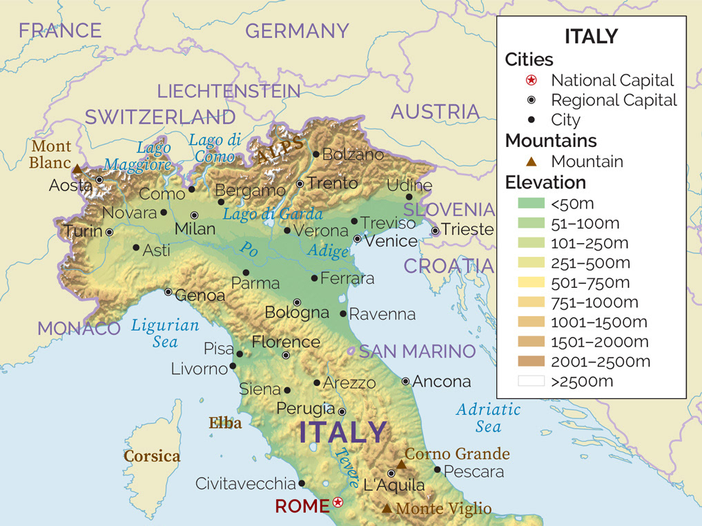
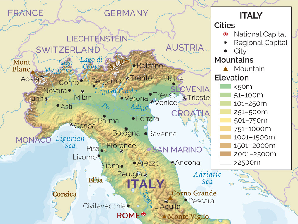
Colour: Elevation
2022
Colour map with elevation and relief shading, cities, rivers and political features
Colour: Topographic & Bathymetry
2022
Colour map with elevation and relief shading, bathymetry, cities, rivers and political features
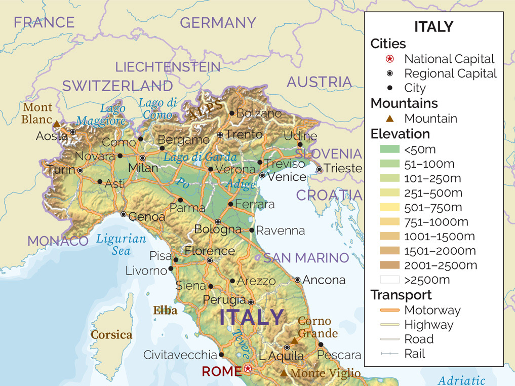
Complex: Roads, Topographic & Bathymetry
2022
Colour map with elevation and relief shading, bathymetry, cities, road hierarchy, rail, rivers and political features
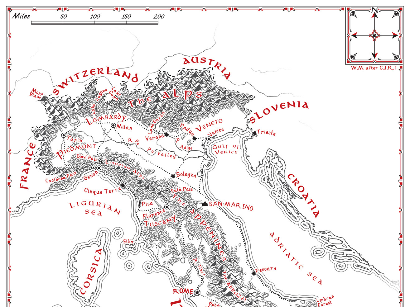
Illustrative: 2-colour Tolkien
2022
2-colour map (red and black only) evoking the style of the Middle-earth maps drawn by J.R.R. Tolkien's son Christopher Tolkien for the Lord of the Rings.
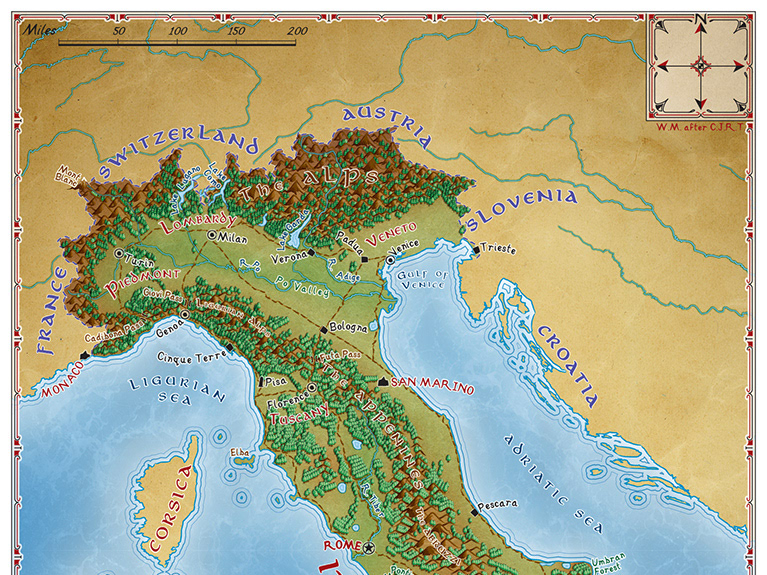
Illustrative: full-colour Tolkien
2022
Full-colour map evoking the style of the Middle-earth maps drawn by J.R.R. Tolkien's son Christopher Tolkien for the Lord of the Rings.
Illustrative: Imhof style
2022
Colour map in the style of Swiss cartographer Eduard Imhof, with stylised elevation and relief shading, cities, road hierarchy, rail, rivers and political features